
Brooke Shields on Life at 58: ‘There Are So Many Moving Pieces’
The model-actress stars in a rom-com, ‘Mother of the Bride,’ streaming on Netflix in May
Cover Stories
Robert De Niro Reflects on Life and Fatherhood
The actor shares the secrets to his legendary career
Ringo Starr Reflects on the Beatles
Fab Four’s heartbeat holds forth on moptop mania
Henry Winkler’s 6 Lessons of Reinvention
The former Fonz is on a career roll at 77
Sheryl Lee Ralph Shares Her Wisdom
‘Abbott Elementary’ star is crafting a life of joy
Jeff Bridges Reflects on His Cancer, COVID Battle
He wasn’t sure he’d be able to walk again
Our Top Picks
Members Only
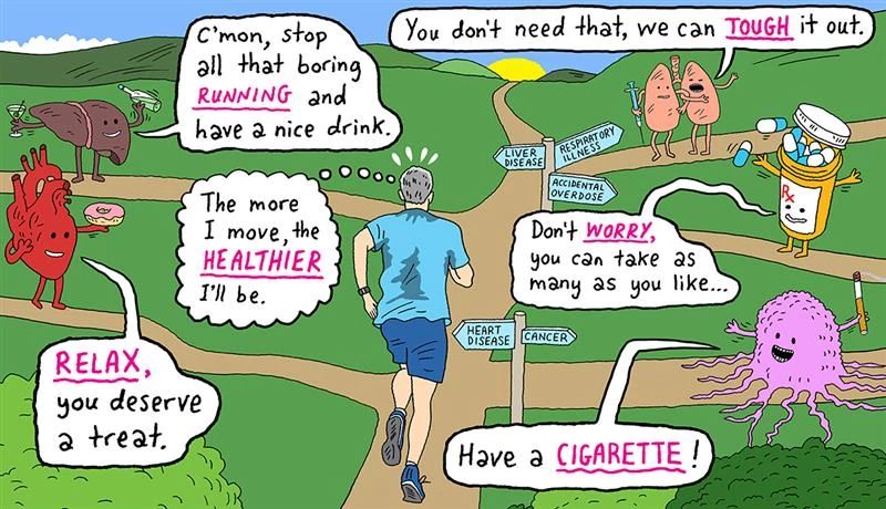
8 Biggest Health Risks at 50 and Beyond
Here are the deadliest threats to people ages 50-plus, and how to keep them from catching up with you

Scams & Fraud
6 Common Types of Investment Fraud
Learn the red flags for financial scams from these recent criminal cases

Members Only
50 World Changers Turning 50 This Year
1974 brought us Nixon’s resignation, supermarket barcodes and ‘Happy Days’

Members Only
Michael Douglas Gets Colonial in ‘Franklin’
The actor portrays the witty Founding Father in new Apple TV+ miniseries
Health
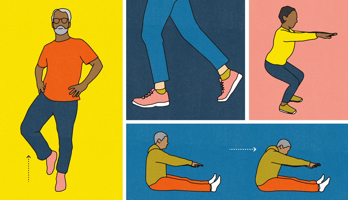
5 Tests to See How Well You Are Aging
Take this series of self-tests to find out if you’re above average

Members Only
8 Pilgrimages You Can Make in the U.S.
Plus 3 popular international ones, including Mecca and Beatles sites

Podcast: Today’s Tips from AARP
The latest advice and tricks to help strengthen your health, money and happiness – all in less than 5 minutes

AARP The Magazine 65th Anniversary Bonus Edition
An extra, digital-only edition that explores aging across a wide range of reports
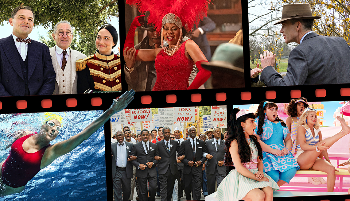
Movies for Grownups 2024 Awards: Meet the Winners!
Many of the films honored in the AARP Movies for Grownups Awards dramatize real people and events
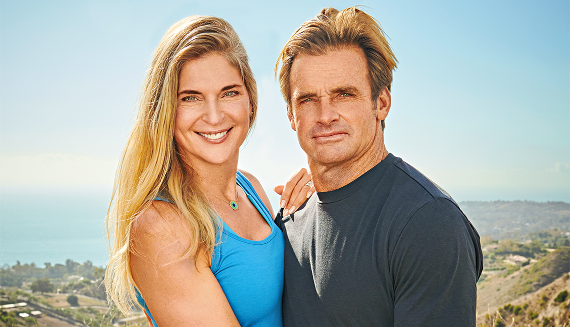
5 Fitness Tips From Gabby Reece and Laird Hamilton
Two sports icons on how they make their lives, their marriage and their fitness goals align
Don't Miss

AARP Explores Music and Memory
Music has immense power. Its melodies can unite us emotionally, and its rhythms can move us physically

March on Washington Participants Look Back
For the 60th anniversary of the march, attendees share their memories of the nation-changing event

Breakthrough Medical Advancements for Patients
New research is changing the future for older Americans. Here’s a sampling of the good news
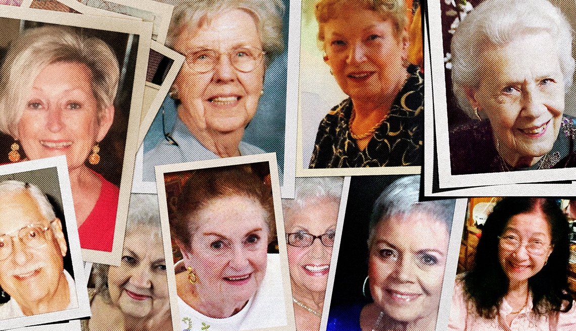
Unnatural Causes: The Texas Serial Elder Murders Case
Police and others made it easy for a serial killer to continue his spree against older women